“Crack!”
A rock the size of a bread loaf bounced off a ledge above, whizzed by my head, spun right over Gary and landed a good forty feet below the two of us with a “Whump,” exploding into smaller pieces on a lower abutment.
That was close, I thought, grasping a granite knob and hugging the cliff.
“Hold up!” I hollered upward. “You’re dislodging rocks.”
“Sorry!” came Chris’s reply, echoing off the surrounding vertical scarps.
*
Our 2018 Sierra summer backpack trip was formulated when five of us met to devise a creative plan. We were all busy with our respective lives, so we had only five days to drive in, do the march, and then drive back home. That was it. Five days. The trip had to be choreographed or it wouldn’t work. We required food for four days on the trail, plus a safety reserve, two trustworthy vehicles, and a scenic round-trip route. None of us wanted to walk out the same trail we were walking in.
Short round trips are challenging in the vastness of the High Sierra. So it was that we studied trail maps, examined mountain landscapes on Google Earth, and read online YouTube accounts and commentary of other hikers. It seemed that we could actually accomplish a partial round-trip in four days, but only if we bridged two different trail systems by an overland, off-trail excursion over the rocks and then down a treed incline a couple-thousand feet to a trail below. We would leave the John Muir Trail, just below Muir Pass, and proceed westward five or ten miles over to Goddard Canyon and its trail system. Our research didn’t reveal any obvious rock walls or drop-off in the way.
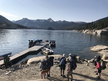
Five of us eventually plunged forward into a seemingly predictable and stress-free mountain adventure. The Florence Lake ferry deposited us near the John Muir Trail where we headed upward toward the Evolution Valley.
Then we walked.
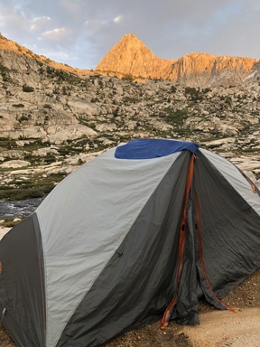
Two days in, at Evolution Lake, an afternoon thunderstorm drenched us and threw lightning bolts helter-skelter, forcing us to sprint for a rare flat spot, erect our tents, and then duck inside for our own safety. The air smelled of ozone. Were wet tents safe? We had no idea. We were simultaneously terrified and ecstatic. Perhaps that should have been an omen.
*
On the third day we departed the trail and, using maps and a GPS device, headed west. We were following our plan. There was no real route—only topographic lines, what we could see, and our questionable sense of direction. Dropping down into a high alpine basin between river valleys, we were soon fully committed. At that altitude every step we took in retreat would be uphill and twice the effort. So we just kept marching.

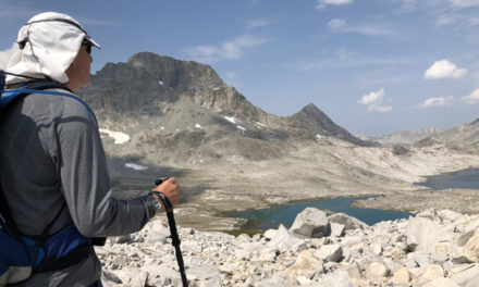
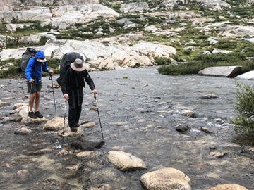
The first couple miles had appeared from our Googling as an expanse of smooth glaciated granite. It wasn’t. It was a vast boulder-field of car to house-size rocks that often had to be climbed over on all-fours or jumped one-to-another. What should have taken twenty minutes took two hours.
Our intrepid guide was Allen, another old guy but one who had long ago retired following his personal successes and then proceeded on a path of repeated adventures. One such quest was an overland trek across the South Georgia Island icefields on the path of Antarctic survivor Shackleton, who had fled from his ice-locked ship Endurance in 1915. Nothing fazed Allan.
When we arrived at the second of two lakes, our route became a choice: climb up the rocks to a small pass to reduce the trip around the lake’s crescent-shape and avoid what looked to be cliffs along the lake’s edge—not shown on the topographic maps; or go completely back around the lake and navigate a steep talus slope that angled straight down into deep waters. We listened to Allan’s advice, voted, and scrambled up over the pass. Predictably, that placed us at another rocky lake bounded by cliffs and ledges of its own, which had to be negotiated before we might get back down to our intended route along the crescent lake. Two more hours passed.
We eventually reached the crescent lake’s edge by precariously descending a series of unstable granite chutes, then sat down and studied our maps. The wind picked up and it began to lightly rain. More thunderstorms were on the way, as we could hear the rumbling in the distance. We ate a quick meal, rubbed our feet and pushed on.
Within fifteen minutes we realized the lake’s far edge had turned into a one-hundred foot cliff, dropping straight into dark waters—not a route for backpackers. We were crushed. To reverse course and revert to the other side of the lake might be a day’s endeavor.
Alan wouldn’t be dampened, even in the rain. He reasoned that we should climb upward, far above the cliffs, to see if the route might be tackled from a much higher point on the mountain, closer to an ice field we could see coming down from the peaks. He dropped his pack and made the reconnaissance as we waited in the increasing rain.
Forty five minutes later Allan returned, soaked, with a story of a “do-able” route down the upper cliffs next to the ice. Begrudgingly, with thunder getting louder, we took the bait and trudged upwards, grasping roots and available handholds as we pulled ourselves over wet outcrops and up loose talus chutes, much on all-fours. Finally we stood where he’d stood when he claimed to see the way down. It was there, all right, but it was down a precarious series of broken ledges across a disheveled cliff face that might have been a hundred feet or more. It was nothing any of us hadn’t done before, but not in the rain and not with full backpacks.
We stood and discussed the route. Four-letter words were flung about. There could be no mistakes on those wet surfaces.
*
I looked at Gary. We both moved carefully down over some bushes to the first of many ledges, where we looked over and noted how they angled down the cliff in broken patterns, and how each had rather sheer drop-offs directly below. I wondered what we couldn’t see—or what Allen might not have seen.
“I think we’ll be facing the mountain,” I volunteered and turned around. The weight of my pack seemingly wanted to pull be over backwards, so keeping a firm grip on the rock was critical.
“Indeed” replied Gary.
“After you.”
Gary and I began a calculated descent, taking turns, one moving while the other watched, so as not to loosen rocks and not to become over-committed if the lead descender ran into a sheer drop-off. We moved slowly, looking out for each other, facing the rock, grabbing and testing handholds, then lowering legs and feet toward stable looking clefts below, never shifting our weight without a secure lock on the mountain. Ropes would have been a splendid idea, but we had none.
Twice I asked Gary, “Think we’re going the right way?”
“There’s a right way?” he first responded back. “You mean with ropes; or maybe around the other side of the lake?”
The second time I asked the question, he just laughed.
Halfway down we heard Chris lament, “I’m slipping!” Some rocks came tumbling our way.
Then we heard a wailing, moaning noise.
“What was that?” I asked, looking upward.
“Maybe a banshee?” replied Gary
“A banshee. That it was it was,” I chuckled. Inwardly I wondered who a mournful banshee might be calling for. Yet I was relatively sure what made the noise—who made the nose. Chris.
The shred of humor momentarily relaxed the nervous ball in my clenched stomach. The descent was a repeated series of stops to breathe and shake off the fear of rolling backward down the rocky face. My grasping knuckles were white.
I didn’t envy Chris’s coke-bottle-lens view of the cliffs below him, especially in the rain. It must have appeared like a blotchy Van Gogh painting of a bottomless-void.
“Allan, you helping Chris?” I called upward.
“No worries,” I heard Allan reply.
I knew Allan would literally move Chris down the mountain, letting Chris place his feet upon his own gripping hands, if he had to. That’s the kind of guy Allan seemed to be. Plus, he’d walked us into this mess. Gary and I let him deal with Chris.
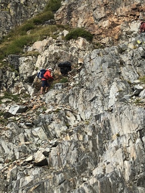
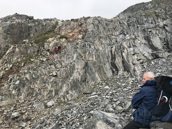
Gary eventually made it to the bottom, then me, whereupon we walked across the scree to a vantage where we could spectate as Allan and Chris moved downward, one ledge after the other. I tried to imagine what the descent might have been like if I were blindfolded and someone were directing me. That made me shudder.
There were periodic oaths and whimpering coming from the cliff face as Chris worked his way down with Alan’s guidance.
“Almost down!” I yelled out—a bald-faced lie. They had fifty feet to go.
“Screw you!” came Chris’s reply.
At least Chris could articulate normally, despite his paralyzing fear. His mind was functioning just fine. He’d be okay.
Jack, Chris’s son, stuck close to his dad until he decided Chris would actually make it down alive, then he effortlessly bolted down the slope like a goat. Gary and I just laughed.
*
As we regrouped on a mountain sheep trail leading west from the cliffs, we looked back at our improvised route over the rocky shoulder of the mountain. We knew we had dodged some kind of bullet to keep on time with our itinerary. We simply had to be back as scheduled, lest we run out of food or be a day late for our obligations. So it had been many other times before.
I looked over at Chris, who had finally quit shaking from the combination of fear and cold. He was cleaning his glasses, perhaps to look back at what he never saw too clearly in the first place. He shook his head.
“That was cool,” expounded Jack, as several of us tipped water containers upward. He was smiling.
“Yep!” laughed Gary shaking his head. “Cool!”
“Nice navigating,” I said to Allan. “Couldn’t have done that without your expert eye for perilous routes. Maybe I wouldn’t have done that if I were saner.”
Everyone nodded and laughed.
“Agreed,” replied Chris, who then turned to Gary and me saying, in a lower voice, “Next time I go packing with Allan, I’m bringing ropes.”
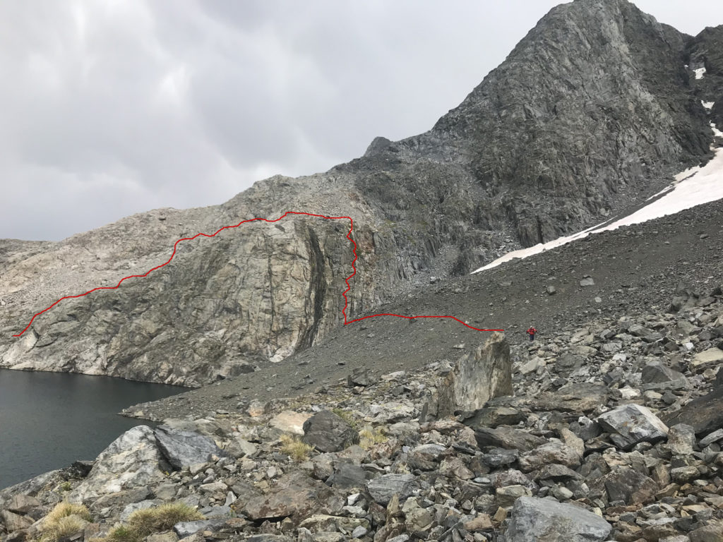
(Our route in RED)

